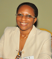
Dr Jane Bemigisha
May 11, 2020

Dr. Jane Bemigisha is the Executive Director, ESIPPS International Ltd. She holds a PhD in natural resources applying “Hyperspectral Remote Sensing and Participatory Geographic Information System (PGIS) for Mapping Livestock Grazing Intensity and Vegetation in Transhumant Mediterranean Conservation Areas” from C.T. de Wit Graduate School-Production Ecology and Resource conservation – PE&RC, Wageningen University, and the International Institute for Geo-information Science and Earth observation (ITC), the Netherlands. She has a MSc. (with Distinction) in Environmental Systems Monitoring and Analysis from ITC and holds a BA in Geography majoring in land use, resource assessment and applied climatology.
Jane has research experience and skills in integrating scientific, expert and local indigenous knowledge using participatory stakeholder engagement, GIS and remote sensing applied in various countries within Africa and Europe.
Dr. Bemigisha has about 30 years professional carrier, highlighted by high level awards, initiatives and memberships at national, regional and international levels as follows: At national level, Dr. Bemigisha is a Uganda Golden Jubilee Independence Medalist awarded at Women’s day celebrations of March 8th 2019. The medal is specially awarded by H.E The President of the Republic of Uganda to personalities who have excelled in their professions and have
greatly contributed to the economic development of the country and or livelihoods of the communities they serve. This places Dr. Bemigisha amongst distinguished women of Uganda to receive the medal. She was awarded the medal on account of her contribution to environmental conservation, planning and documentation including the use of location-based databases and geo–spatial mapping technologies such as Geographic Information Systems (GIS) and remote
sensing using satellite imagery and Unmanned Aerial Vehicles (UAVs) or drones.
Dr. Bemigisha is at ESIPPS working to integrate remote sensing by satellite and Unmanned Aerial Vehicles (UAS) or drones for environmental conservation and agriculture, particularly supporting setting up of crop and pasture spatial or location-based farm databases and monitoring vegetation in wildlife protected areas. ESIPPS is leading the setting up of farm registration and drone mapping in a new SPATIAL FARMS system initiated mainly through capacity development for agro-associations and businesses. For example, capacity at NUCAFE and Igara Tea Growers Factory (IGTF) has been built to set up location-based databases for traceability, internal management and for building credibility of farmers to access credit, insurance, inputs and other services.
ESIPPS is further together with a Ugandan space company and National Council for Science and Technology championing the establishment of a Space Program for Uganda. ESIPPS mainly focuses on Earth Observation and Telecommunications space segments. The contribution to Earth Observation includes services in satellite remote sensing and drones for research, surveys and mapping of resources for sustainable development. ESIPPS spearheads an initiative to set up a spatial information resource center /library in partnership with Makerere University
Department of Geography and Climatic Sciences; the College of Computing and Information Science; and National Council for Science and Technology.
Dr. Bemigisha is a Uganda National focal point for Regional African Satellite Communications Organization (RASCOM). RASCOM has a mission: to design, implement, operate and maintain the space segment of the African telecommunications satellite system and translate into services and tools for African integration, all the opportunities provided by satellites by linking it, where necessary, with any other appropriate technology. RASCOM works to ensure the sustainable development of
telecommunications in the continent and in each African country, with special emphasis on service
to rural areas. Collaboration with Uganda Telecom Limited is underway in this effect. While working at the National Environment Management Authority (NEMA) Jane helped set up the first National Geographic Information System (GIS) laboratory to support environmental decision making in Uganda and continues with her Company ESIPPS to support NEMA on environmental assessments, data and reporting through development of National State of
Environment Reports (NSOERS). ESIPPS has also supported the Ministry of Energy and Mineral development to carry out the first ever strategic Environment Assessment of Oil and Gas in the Abertine Graben; and supported Ministry of Water and Environment to develop a state of Lake Victoria basin report, generating information and an atlas for planning and decision making. Till 2016, Jane lectured (part time) in land use and land evaluation. She still conducts external examination for Masters and Doctorate students applying GIS and remote sensing technologies in their dissertations at Makerere University, Kampala.
At Uganda Wildlife Authority, Jane participated in setting up a general management planning system for wildlife protected areas and she is now initiating a program to map monitor and manage invasive plant species using drones and satellite images. Under a USAID/ Wildlife Conservation Society (WCS) Uganda Program on Wildlife, Landscapes and Development for Conservation (WILD) for post conflict Northern Uganda, Jane set up an ecological land use planning program integrating the use of Geographic Information Systems and Remote sensing technologies. She implemented two strategic objectives:
- Improved knowledge of biodiversity and land use: management of surveys, research and
GIS facilities at WCS and Gulu University; and - Ecologically responsible natural resource management and economic livelihood options
promoted: developing and managing tools and building capacity by training in land use
planning and financing implementation of model environment action plans by District Local
Government officials.
At regional level, Dr. Bemigisha is a member of the African Scientific Research and Innovation Council Congress (ASRIC). The objective of ASRIC is to promote scientific research and innovation in order to address the challenges of Africa s social-economic development. Jane has served as team member on High Level panels and assessments under the Global Monitoring of Environment and Security (GMES) & Africa program of the African Union
Commission.
Dr. Bemigisha has served as manager Africa Hub of International Foundation for Science supporting scientists in research by managing grants and training in the area of water and biological resources. Until October 2016, Jane was a Coordinator, Africa Chapter of International Association of Landscape Ecologists (IALE).
Jane is a member, Board of Directors, Albertine Rift Conservation Society (ARCOS). ARCOS is a regional conservation organization founded in 1995 with the mission to enhance biodiversityconservation and sustainable management of natural resources in the Albertine Rift region, Africa Great Lakes region and African Mountains through the promotion of collaborative conservation actions for nature and people.
Jane has developed a State of Environment Report and strategies on establishing environmental information center and institutional framework for the Federal Republic of Somalia. She has also worked in Kenya, Rwanda and Democratic Republic of Congo on climate resilience and conservation projects.
At International level, Jane has served as vice Co-chair, 2016 – 2019 of the UN Environment Sixth Global Environment Outlook and member since 2014 of UNEP Community of Practice responsible for global environmental assessments and preparation of Environment Outlooks. She has been Contributor, Group on Earth Observation- Biodiversity Observation Network (GEO-BON) handling ecosystems change; served on task team ID-01 Advancing GEO System of Systems (GEOSS) Data Sharing Principles on user engagement plan and Climate Information for Adaptation. Jane participates in AFRIGEOSS – an initiative aiming to strengthen the link between the current GEO
activities with existing capabilities and initiatives in Africa promoting Earth Observation-based initiatives across Africa
Related Articles
July 16, 2024
Flood Monitoring for Uganda
On 12th July 2024, ESIPPS International Limited had the honor of presenting an innovative concept on flood monitoring for Uganda
Read Article
May 27, 2024
Gender Talk Webinar
GECA RESEARCH INSITITUTE Join us for our Very first Gender talk webinar this Thursday. GENDER TALK WEBINAR Advancing Africa: Integrating

